Travel Times To Cities Around The World
From Britain to China to Mali, new maps showing travel times to the nearest urban centre reveal huge differences between countries. Using Open Street Map and Google, a University of Oxford team have created a visual breakdown that suggests major inequalities when it comes to commuting.
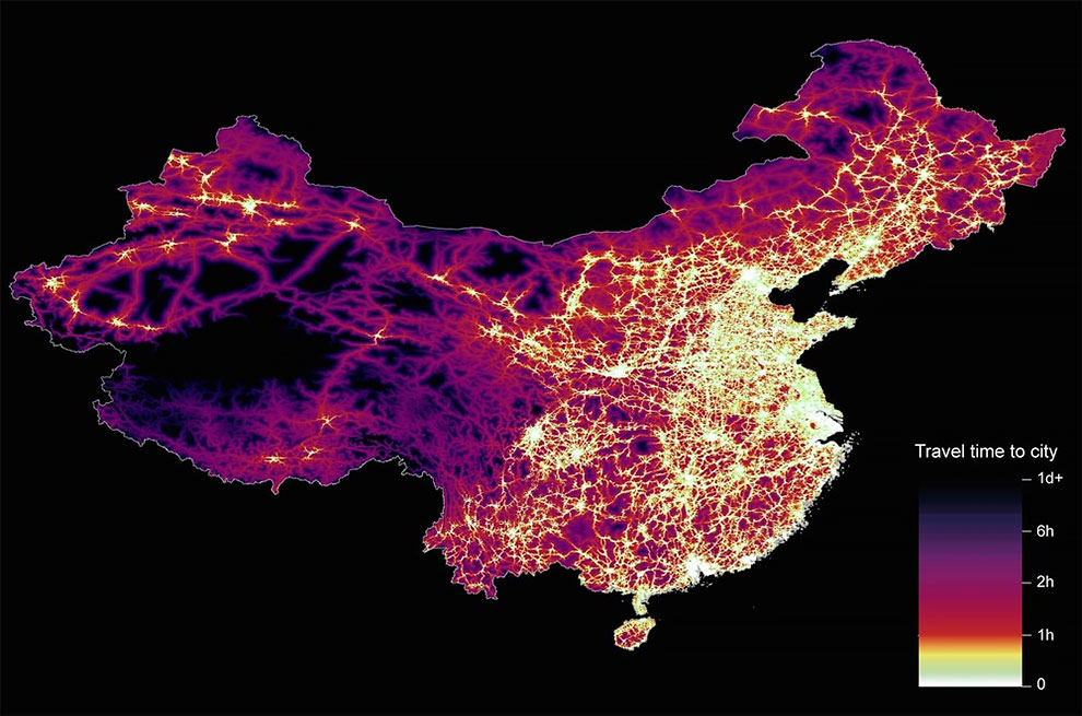
China. The dataset used for China was unique as it relied solely on Open Street Map, due to restrictions on accessing Google data. The population is densely concentrated in the east and accessibility is increased, whereas rural provinces in the west remain remote. (Photo by Daniel Weiss/Jennifer Rozier/Malaria Atlas Project/University of Oxford)
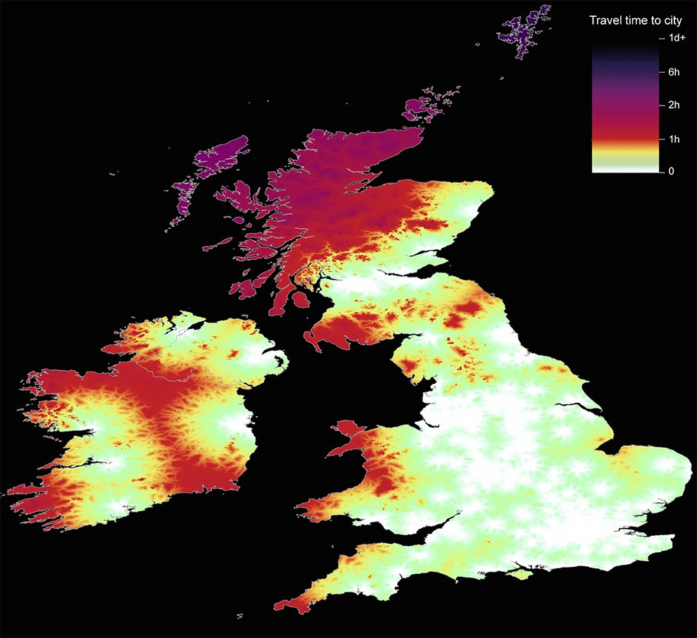
Great Britain and Ireland. Due to a high density of urban centres in Britain and Ireland, accessibility is largely unimpeded – shown by light colours. Only in the highlands of Scotland are travel times increased, as indicated by dark colours. For their article in the journal Nature, Daniel Weiss and his colleagues used Open Street Map and Google to collate travel times to cities in 2015. (Photo by Daniel Weiss/Jennifer Rozier/Malaria Atlas Project/University of Oxford)
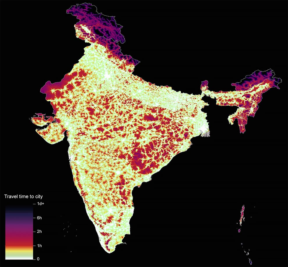
India. Nearly 91% of people in high-income countries live within one hour of a city, compared to almost 51% of people in low-income countries. India’s high population and large number of cities complicates this picture. (Photo by Daniel Weiss/Jennifer Rozier/Malaria Atlas Project/University of Oxford)
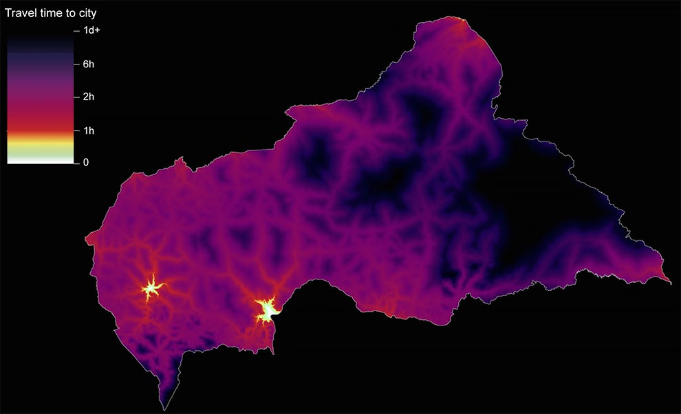
Central African Republic. The map for the Central African Republic shows a more typical correlation between low income and inaccessibility. With only two urban centres located on southwestern side of the country, the east remains largely remote. (Photo by Daniel Weiss/Jennifer Rozier/Malaria Atlas Project/University of Oxford)
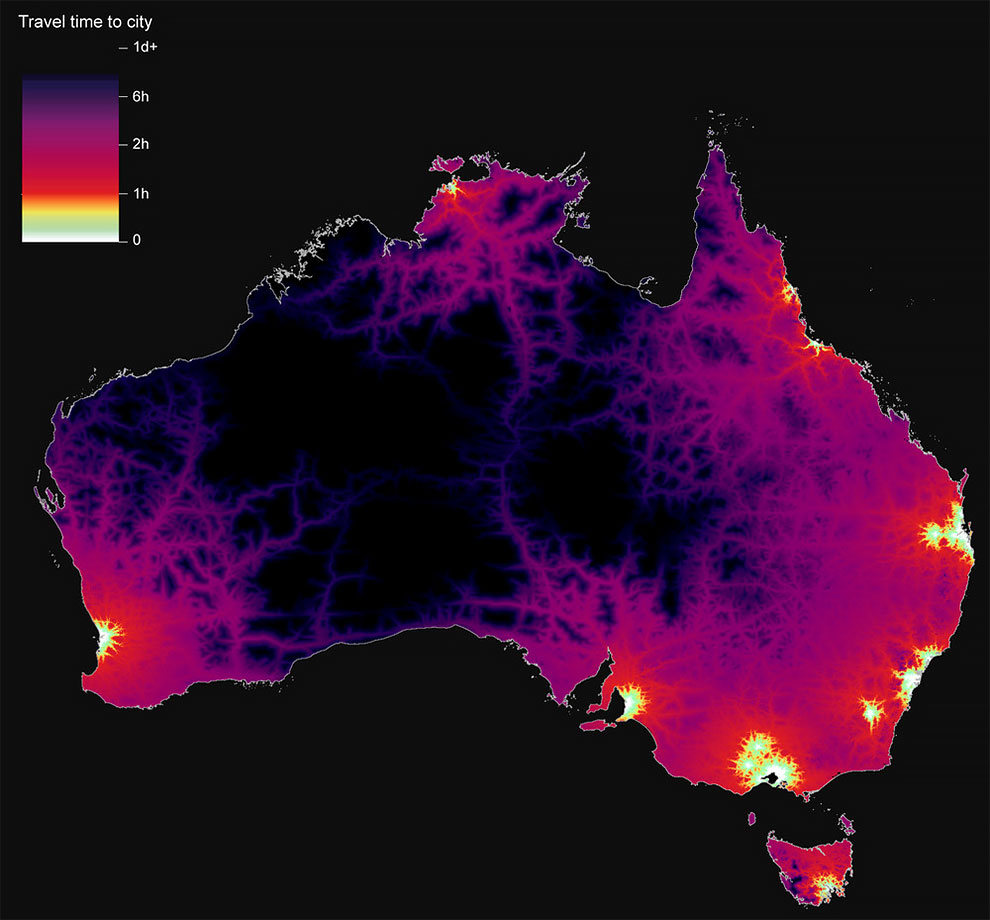
Australia. With urban centres located along the coastline, Australia displays what Weiss calls a ‘vast, dark middle’ through the outback. For a high-income nation, accessibility to all areas of the country is limited; however, routes to the busiest cities are numerous. (Photo by Daniel Weiss/Jennifer Rozier/Malaria Atlas Project/University of Oxford)
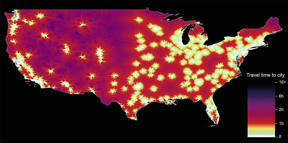
USA. Despite the lack of large urban centres in areas like Nebraska, the US has “remarkable infrastructure”, says Weiss. Unlike Australia, both rural areas and cities are well connected. (Photo by Daniel Weiss/Jennifer Rozier/Malaria Atlas Project/University of Oxford)
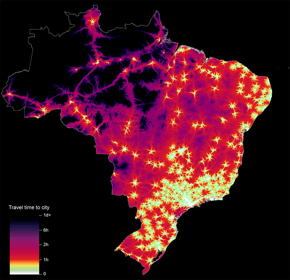
Brazil. The large roads carving through the borders of the Amazon display the correlation between infrastructure and deforestation in Brazil. Proximity to urban centres has a protective effect on forests, as the majority of deforestation occurs one to five hours travel time from cities. (Photo by Daniel Weiss/Jennifer Rozier/Malaria Atlas Project/University of Oxford)
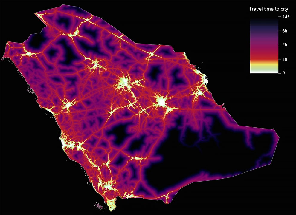
Saudi Arabia. With an overwhelmingly urban population – one of the highest of the countries analysed – Saudi Arabia has some of the longest travel times to city centres. It’s an exception to the relationship between high income and accessibility. (Photo by Daniel Weiss/Jennifer Rozier/Malaria Atlas Project/University of Oxford)
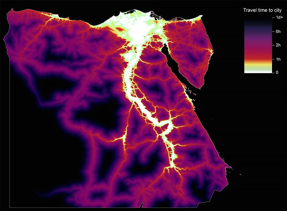
Egypt. Urban centres are located along the banks of the Nile in Egypt, forming a virtual map of the river itself, with the desert in the west of the country remaining especially remote. (Photo by Daniel Weiss/Jennifer Rozier/Malaria Atlas Project/University of Oxford)
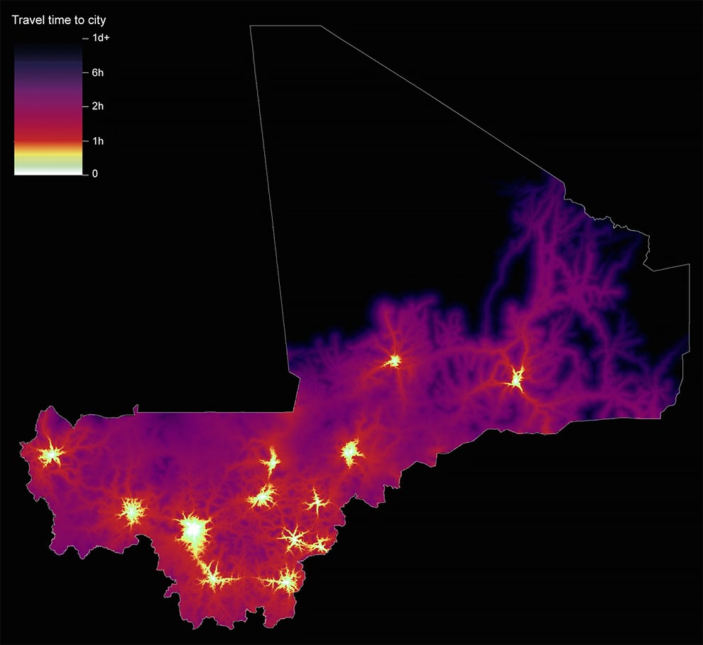
Mali. Much like the Central African Republic, accessibility in Mali is limited to a handful of urban centres, with the desert in the country’s north a vast swathe of inaccessibility. (Photo by Daniel Weiss/Jennifer Rozier/Malaria Atlas Project/University of Oxford)
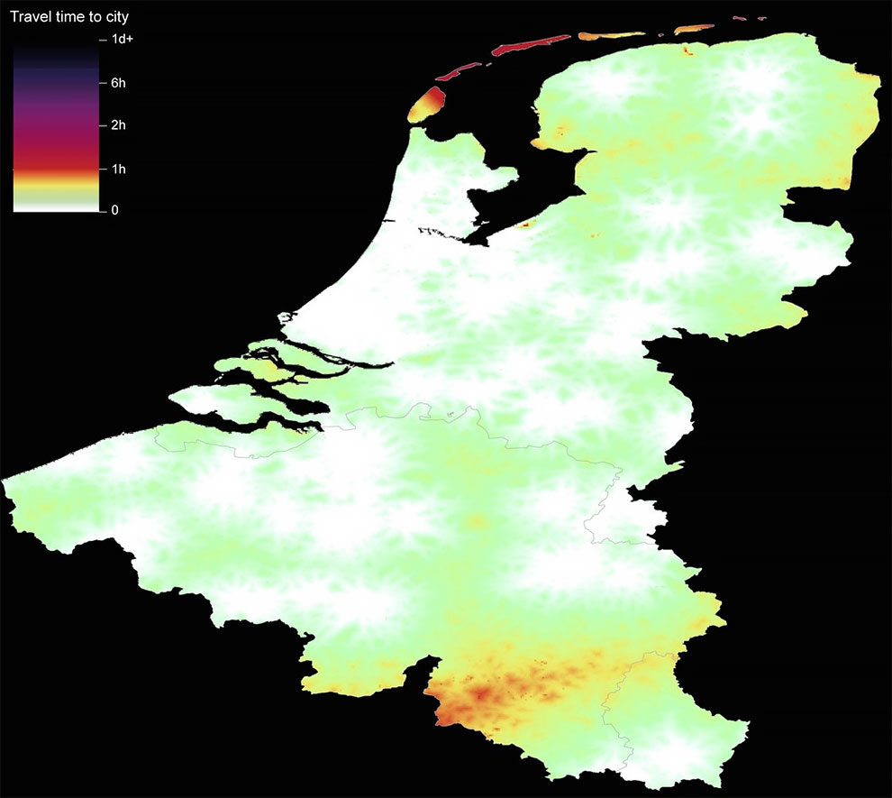
Belgium, the Netherlands and Luxembourg. Perhaps the most well-connected of the European nations, Belgium, the Netherlands and Luxembourg provide a stark contrast to countries such as Mali. Virtually all urban centres in these three high-income countries can be reached within one hour. (Photo by Daniel Weiss/Jennifer Rozier/Malaria Atlas Project/University of Oxford)
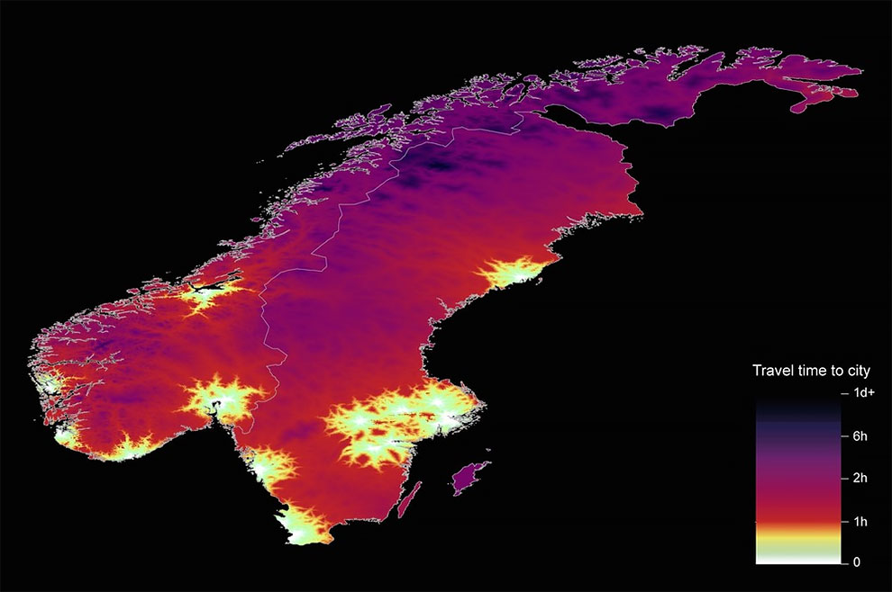
Sweden and Norway. Among western European countries, Scandinavian nations are some of the least accessible. In Sweden and Norway, woodlands in the north have limited infrastructure. (Photo by Daniel Weiss/Jennifer Rozier/Malaria Atlas Project/University of Oxford)